
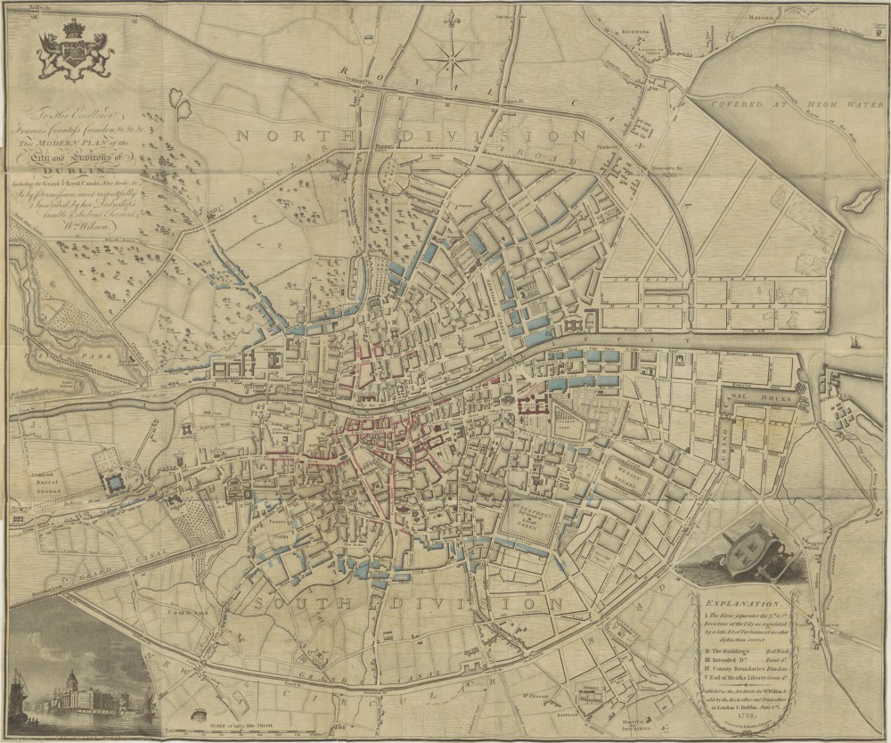
This reproduction of a wonderful map of the city of Dublin, originally created by William Wilson, comes from Observations on Mr. Archer’s Statistical Survey of the County of Dublin, by Hely Dutton. The book was first published in 1801, at which time this was a very up-to-date map. (You’ll also find a map of the country in 1795 reproduced in the same work, which was scanned and digitised by the British Library Labs.)
Of course, the city has grown upwards and outwards and many place names have changed, but the street layout of the centre of 2016 Dublin remains very much the same. Many incidents from our Irish novels can be pinpointed to locations on this map; for example, the now hundred-year-old novel A Portrait of the Artist as a Young Man, Stephen Dedalus recalls a scene from his youth in which he has an altercation about poetry with some of his fellow pupils while walking home via the Drumcondra Road. This is the central thoroughfare which can be seen leading away north off the top of the map.
Stephen and the other boys in fact take the last visible turn right off Drumcondra Road, onto what was an unnamed track on this 1798 map, joining up with the (now lost?) Fortrick’s Lane, but which is now (and was in 1916) Clonliffe Road:
As soon as the boys had turned into Clonliffe Road together they began to speak about books and writers, saying what books they were reading and how many books there were in their fathers’ bookcases at home. Stephen Dedalus listened to them in some wonderment for Boland was the dunce and Nash the idler of the class.
This part of town can also be seen on the Ordnance Survey Ireland Historic Map Viewer, which shows a considerably more built up area. (This is a slightly later projection: the area was surveyed in January 1837 and this map sheet, DN018, was published in 1844.)
The boys abandon Stephen after their scuffle (ostensibly about the moral rectitude and literary skill of Lord Byron) and he “stumbles homeward” along Jones’s Road, which is the first right turn off of Clonliffe Road (labelled Russell Street on the OSI map). This road appears not to have existed in 1798 – or perhaps this region of the northside just wasn’t very familiar to the mapmaker?
At any rate, it seems likely that one of the “bare cheerless” houses in which the Dedalus family reside through the course of the novel must be somewhere in this vicinity, in what’s now the catchment area for the sports stadium Croke Park. Quite a nice part of the city in 2016 – although perhaps inconveniently busy for residents on match days!
